![]()
|
|
Prehistoric Sites in
WALES
by Martin J. Powell
Page 2 of 5
Click on a thumbnail to see a full-size picture. The Ordnance Survey Map links (O.S. Map) point to the 1:25,000 scale map of the region (equivalent to the O. S. Pathfinder Series of printed maps), as displayed at Streetmap.co.uk.
The abbreviation 'Ast' indicates that the site is included in the archaeoastronomy study of monuments in South Wales.
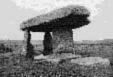
Tinkinswood a.k.a. Castell Carreg Chambered Cairn County: Vale of Glamorgan (South Glamorgan) Ordnance Survey Grid Ref: ST 092 733 O.S. Map (Streetmap) Satellite Photo (Google Maps) Photo Size: 103 KB / Date: December 1990
Excavation revealed the remains of at least fifty people, together with pottery of Neolithic date. A stone-lined pit of unknown purpose is set into the cairn about half way along its length; one theory is that it was used to hold corpses until the flesh had rotted away - a process known as excarnation - after which the bones were placed inside the chamber. Finds from the tomb excavation were recently radiocarbon-dated to around 3700 BC. Following excavation a pillar was introduced into the chamber to add support to the capstone, in which a large crack had developed. The pointed corners of the 'horns' at the eastern end of the cairn are quite unlike most other tombs of this particular type and are likely to be the result of the excavator having incorrectly envisaged the original form of the monument. The 'herring-bone' style of drystone walling seen in the forecourt was added during restoration in order to distinguish it from the original walling seen elsewhere along the cairn. The source of the stones used to built the tomb has often been assumed to be a location known as The Quarry in a field some 330 ft (100 m) to the East of the long cairn. However, an examination of the area in 2011 failed to find any evidence of Neolithic activity. The source of the stones used to construct the tomb is, therefore, unknown. An impression of the original appearance of the tomb is shown in a painting of a burial ceremony at Tinkinswood (ca. 1939) by the artist Alan Sorrell (1904-1974). A megalithic structure located in the adjacent field called The Stable (ST 093 732) to the East of Tinkinswood chamber has long been considered a possible collapsed Neolithic burial chamber. Excavation of the site in 2011 finally settled the mystery: it is a Bronze Age round barrow, measuring about 16 ft (5 m) in diameter. No traces of a prehistoric burial had survived, although a Roman burial had later been inserted into the mound. A large slab lying on top of the mound - once thought to have been a chamber capstone - was determined to be the result of field clearance in the 19th century [Ast] |
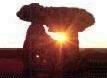
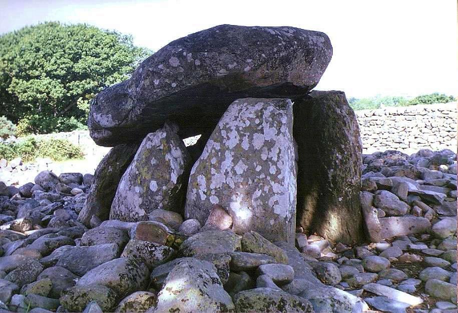
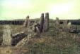
Maen Ceti a.k.a. Arthur's Stone Chambered Cairn County: West Glamorgan O.S. Grid Ref: SS 491 905 O.S. Map (Streetmap) Satellite Photo (Google Maps) Photo Size: 121 KB / Date: April 1987
The cairn around the tomb is circular, approximately 75 ft (23 m) in diameter. It is unlikely that the cairn material ever completely covered the tomb. The site has not been excavated [Ast] |
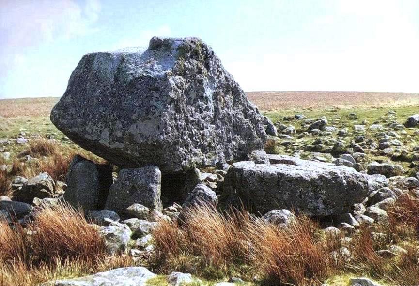
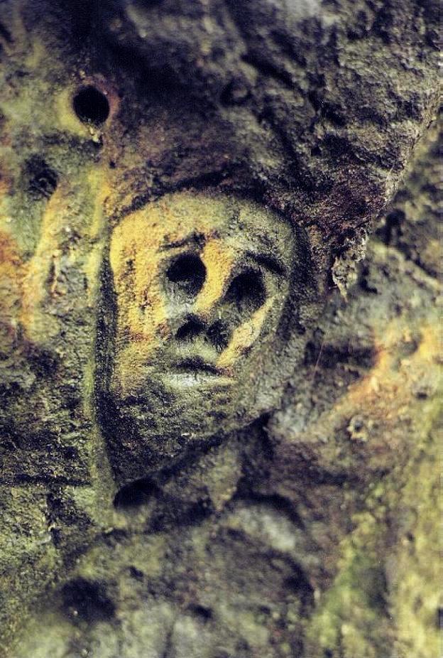
Tarrendeusant Pagan Cult Site County: Mid Glamorgan (Rhondda Cynon Taff) O.S. Grid Ref: ST 052 872 O.S. Map (Streetmap) Photo Size: 128 KB / Date: May 1991
The name tarren deusant translates from Welsh as "rock of the two saints". Another view of the main rock can be seen here (75 KB). |
Sweyne's Howes North Chambered Cairn County: West Glamorgan O.S. Grid Ref: SS 421 899 O.S. Map (Streetmap) Photo Size: 77 KB / Date: April 1988
The Sweyne's Howes South tomb is about 330 ft (100 m) away and is very ruinous. The cairn measures 69 ft (21 m) by 49 ft (15 m) but no chamber survives. The name 'Sweyne's Howes' derives from a local legend which says that a Viking named Sweyne is buried here. 'Howe' is a Norse word for 'mound'. About a half-mile (0.7 km) to the South, high up on the ridge of the Down are a group of round cairns dating from the Bronze Age; one example can be seen on Page 5. |
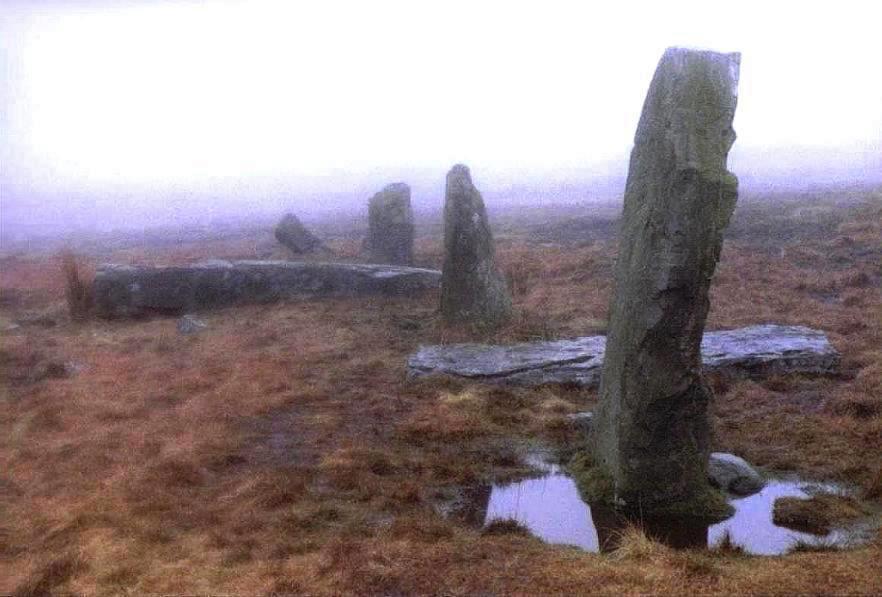
Saith Maen NW (Craig-y-nos) Stone Row County: Powys (Brecknockshire) O.S. Grid Ref: SN 833 154 O.S. Map (Streetmap) Photo Size: 68 KB / Date: March 1989
The row is aligned on a bearing of ca.25-205 degrees. It has been suggested that the row might have been orientated toward the Cerrig Duon stone circle situated 3.4 miles (5.5 kms) to the NNE (see Page 1). The row is suffixed 'NW' in order to distinguish it from two other sites of the same name in Powys county; a prehistoric stone row near Llanwrthwl at SN 949 603 and a natural boulder at SN 861 146 [Ast] |
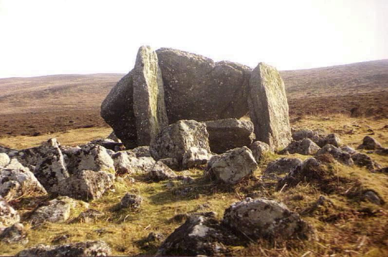
Ffostill North a.k.a. Ffostyll Chambered Cairn County: Powys (Brecknockshire) O.S. Grid Ref: SO 179 349 O.S. Map (Streetmap) Photo Size: 132 KB / Date: May 1991
Ffostill South long cairn, situated some 230 ft (70 m) to the SSW, has at least one chamber, positioned at the Northern end of the mound. The remains of numerous individuals were found between 1921-3 [Ast] |
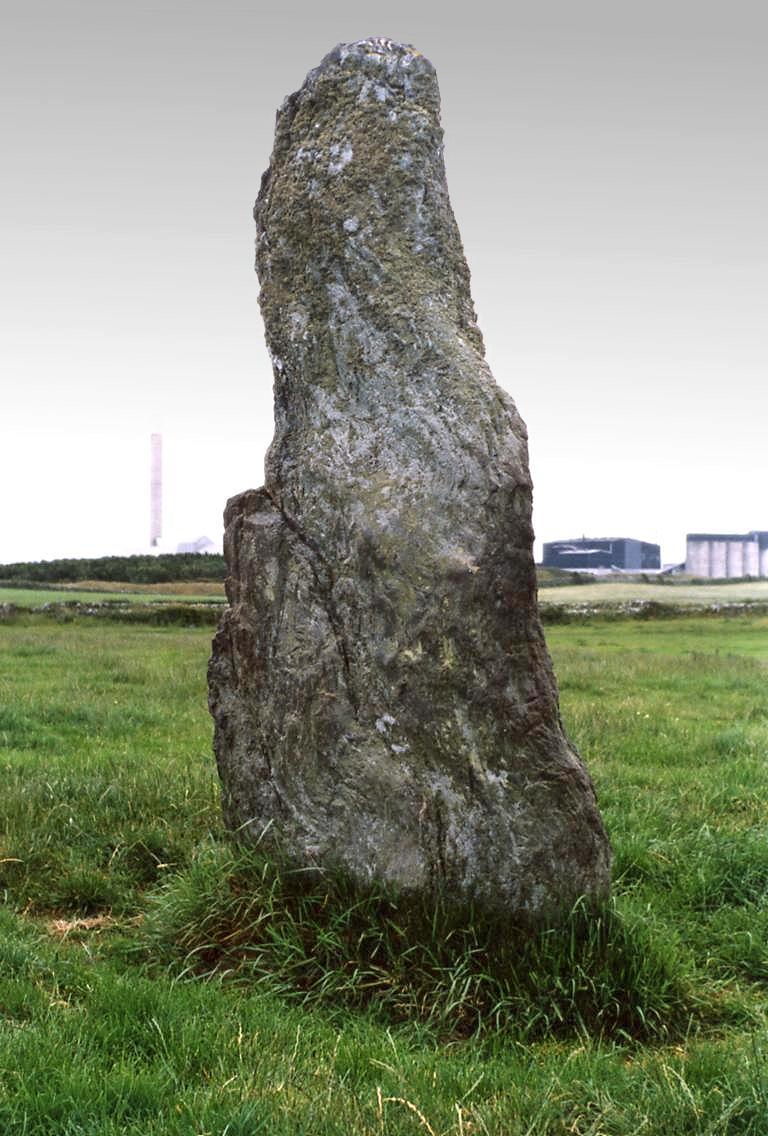
Ty-Mawr Standing Stone County: Anglesey (Ynys M�n) O.S. Grid Ref: SH 254 810 O.S. Map (Streetmap) Photo Size: 129 KB / Date: July 1987
The Ty-Mawr monolith is 8 ft 10 in (2.7 m) tall, 3 ft 11 in (1.2 m) wide and 1 ft 4 in (0.4 m) thick. Its long axis is orientated approximately NE-SW. Without excavation, the date and function of these enigmatic monuments cannot be known; modern-day archaeologists often describe them as having served a 'funerary and/or ritual function'. Alternatively, it might simply be a cattle-rubbing stone, erected here by a farmer just a few centuries ago! The Trefignath Neolithic chambered cairn is about 0.4 miles (0.6 km) to the South-east of the monolith (see Page 4). |
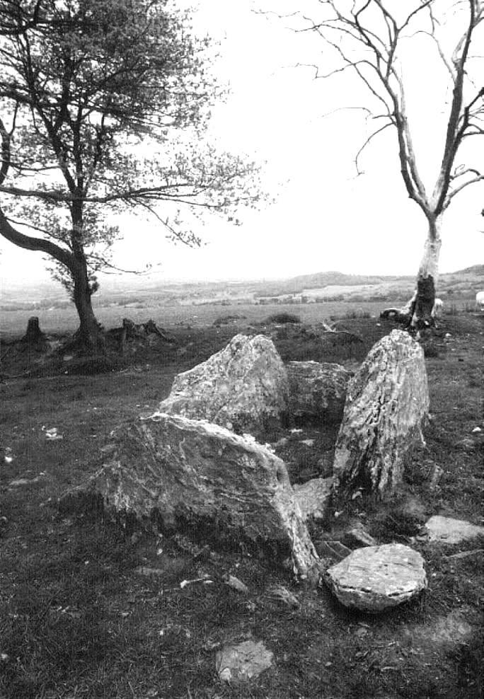
Bedd Gorfal Stone Circle / Cairn Circle County: Gwynedd (Merionethshire) O.S. Grid Ref: SH 613 311 O.S. Map (Streetmap) Photo Size: 99 KB / Date: July 1987
The circle overlooks the picturesque Snowdonia mountain range. |
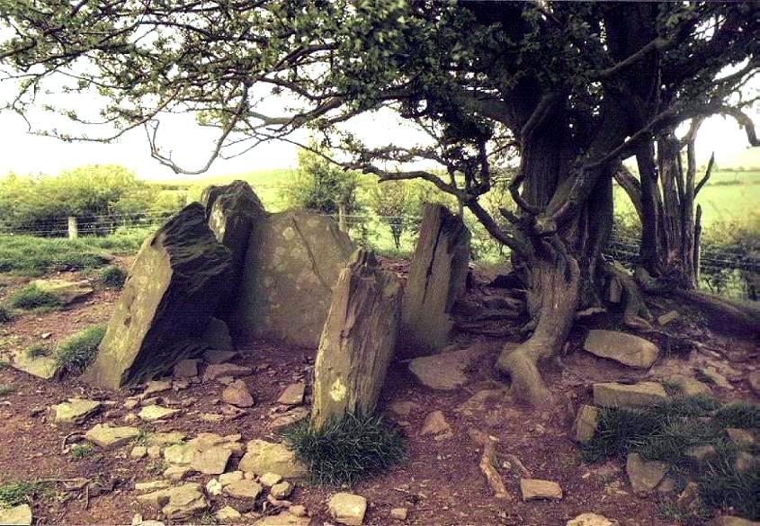
Penywyrlod (Llanigon) a.k.a. Penywrlod Chambered Cairn County: Powys (Brecknockshire) O.S. Grid Ref: SO 225 398 O.S. Map (Streetmap) Photo Size: 135 KB / Date: May 1991
The site was excavated in 1921. The main chamber had been filled with stones and black earth to a depth of 4 ft (1.2 m). It contained the remains of some twenty individuals. The chamber stones were apparently reset following the excavation, so their present arrangement may not be a wholly accurate representation of the chamber's original form [Ast] The site should not be confused with that of Penywyrlod (Talgarth), a long cairn sited some 7 miles (11 kms) to the South-west (see Page 1). |
Dyffryn Ardudwy Chambered Cairn County: Gwynedd (Merionethshire) O.S. Grid Ref: SH 589 229 O.S. Map (Streetmap) Photo Size: 141 KB / Date: July 1987
Rock art, in the form of circular hollows (cupmarks) and a series of grooves, are present on the North and South portal stones of the western chamber. A reconstruction painting of the two chambers by David Gunning can be seen at the National Museum Wales website. |
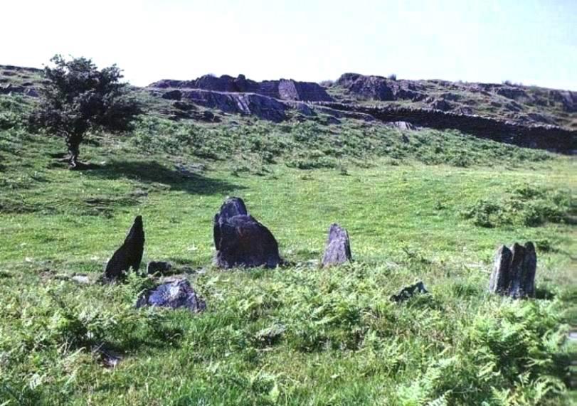
Ynys-Hir Stone Circle County: Powys (Brecknockshire) O.S. Grid Ref: SN 921 383 O.S. Map (Streetmap) Photo Size: 116 KB / Date: March 1991
The wrecked car seen in the picture was riddled with bullet-holes and had clearly been used by the military for target practice! [Ast] |
 Archaeoastronomy
in South Wales
Archaeoastronomy
in South Wales
 Neolithic
Tombs in South Wales
Neolithic
Tombs in South Wales
Copyright Martin J Powell 2001 - 2015
Site hosted by TSOHost |

 A
Round Barrow in Gwent
A
Round Barrow in Gwent