![]()
|
|
Prehistoric Sites in
ENGLAND
by Martin J. Powell
Page 1 of 5
Click on a thumbnail to see a full-size picture. The Ordnance Survey Map links (O.S. Map) point to the 1:25,000 scale map of the region (equivalent to the O. S. Pathfinder Series of printed maps), as displayed at Streetmap.co.uk.
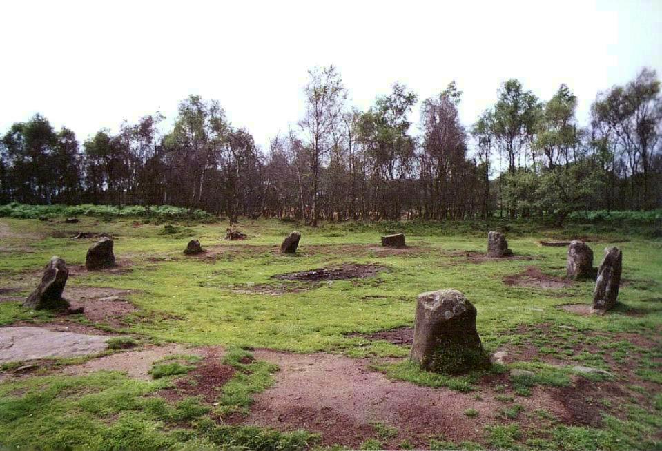
Nine Ladies Stone Circle County: Derbyshire Ordnance Survey Grid Ref: SK 249 635 O.S. Map (Streetmap) Photo Size: 128 KB / Date: July 1988
Nine Ladies is classed as an embanked stone circle, i.e. it has a circular bank of rubble surrounding the stones, although this is barely visible today. There are entrances to the circle (and through the bank) at the North-east and South-west. There was once a cairn at its centre, and in more recent times an unsightly wall was built around the circle; fortunately this was removed during the 1980s. Some 98 ft (30 m) to the South-west of the circle is an outlying stone (an outlier) called the King Stone, which is 2 ft (0.6 m) high. |
Wayland's Smithy Chambered Cairn County: Oxfordshire O.S. Grid Ref: SU 281 854 O.S. Map (Streetmap) Satellite Photo (Google Maps) Photo Size: 88 KB / Date: August 1990
Excavation in 1919, and again in 1962-3, revealed the bones of eight people. The original monument was simply a wooden mortuary structure surrounded by an oval cairn. |
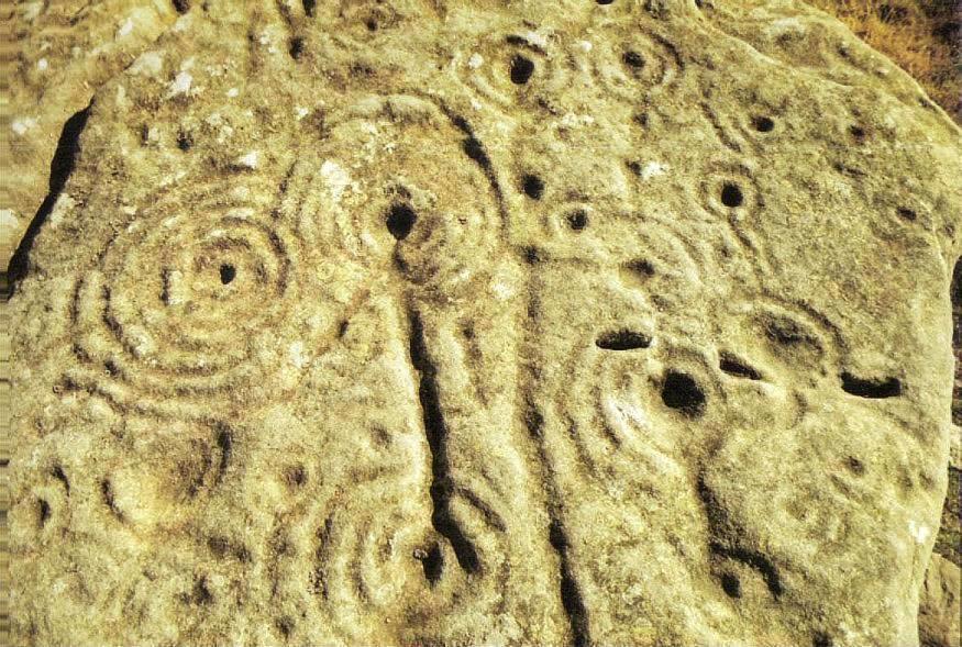
Weetwood Moor Rock Carvings County: Northumberland O.S. Grid Ref: NU 021 282 Photo Size: 120 KB / Date: July 1989
Many hundreds of carvings of this type - often called cup-and-ring marks - can be found scattered across the British countryside, more commonly in Northern Britain. Northumberland alone has over 950 examples of prehistoric rock art. Recent studies have shown that simple, circular carved hollows - known as cup-marks - are most often found on boulders, whilst more complex artwork tends to be found on large rock outcrops, the latter of which seem to have been chosen for their wide vistas. The meaning of these carvings - which are believed to date from the Bronze Age - has not been determined, though many theories have been put forward. One author listed no less than 104 possible explanations for them, including decorations, burial markers, route markers, blood sacrifice containers, copper/gold prospector marks, sex symbols, maps of the countryside, adder lairs, star maps and even messages from outer space! |
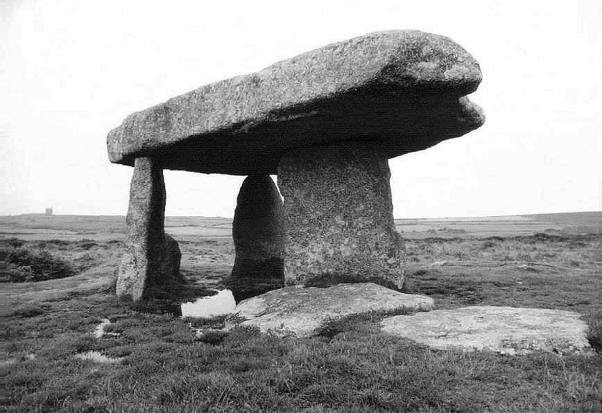
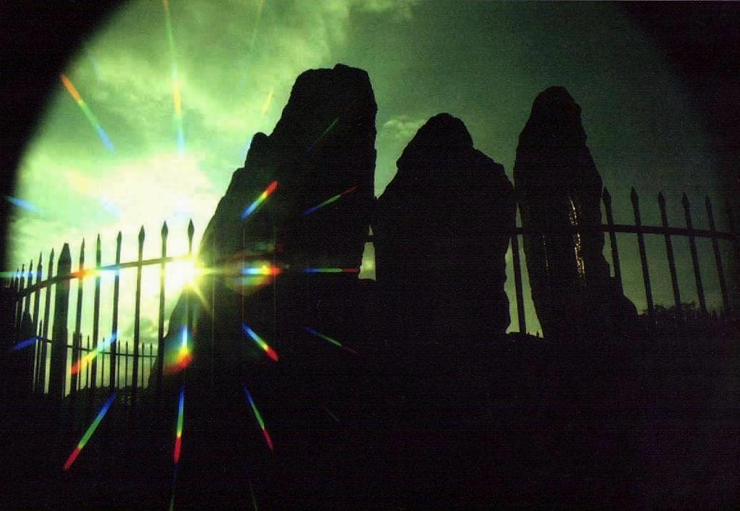
Lanyon Quoit a.k.a. The Giant's Quoit, The Giant's Table Chambered Cairn County: Cornwall O.S. Grid Ref: SW 430 337 O.S. Map (Streetmap) Photo Size: 75 KB / Date: June 1991
The tomb collapsed during a storm in 1815 and nine years later it was re-erected. The uprights are 8 ft (2.5 m) tall, however the original height would have been greater had it not been for the fact that one of the stones broke during the course of the reconstruction. The current layout of the chamber therefore cannot be relied upon. The surrounding cairn has been heavily robbed and measures 88 ft (27 m) long by 39 ft (12 m) wide. A disused tin mine - frequently found across the Cornish peninsula - can be seen in the distance. |
Old Bewick Rock Carving County: Northumberland O.S. Grid Ref: NU 078 216 O.S. Map (Streetmap) Photo Size: 144 KB / Date: July 1989
Close to a field boundary about 0.6 mile (1 km) East of Old Bewick hamlet is a tall, squarish block of rock decorated with a large series of circular hollows (cup-marks) with surrounding rings and connecting grooves (cup-and-ring marks). Several rocks in the vicinity display similar forms of rock art. |
Five Wells Burial Chamber County: Derbyshire O.S. Grid Ref: SK 124 710 O.S. Map (Streetmap) Photo Size: 139 KB / Date: July 1988
The skeletal remains of 17 people were found in the chambers during excavation in 1846, together with Neolithic-style pottery, arrowheads and a flint knife. |
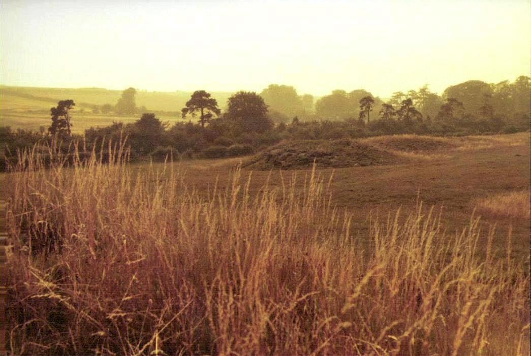
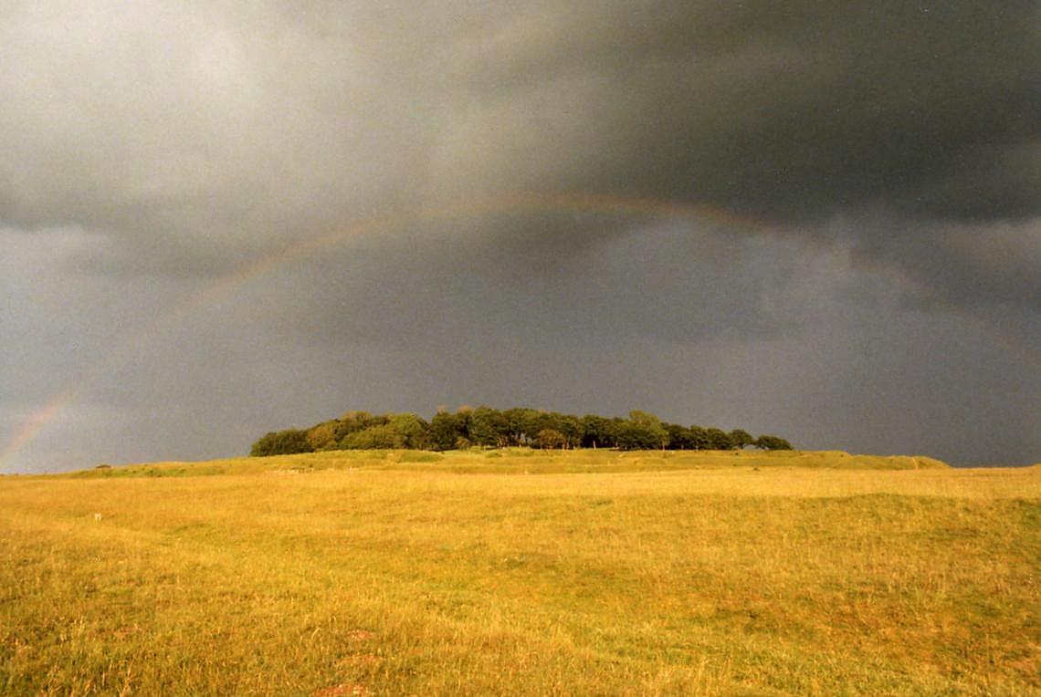
Lambourn Seven Barrows Round Barrow Cemetery County: Berkshire O.S. Grid Ref: SU 328 828 O.S. Map (Streetmap) Satellite Photo (Google Maps) Photo Size: 96 KB / Date: August 1990
The two main rows of tumuli are aligned approximately ESE-WNW and SE-NW. |
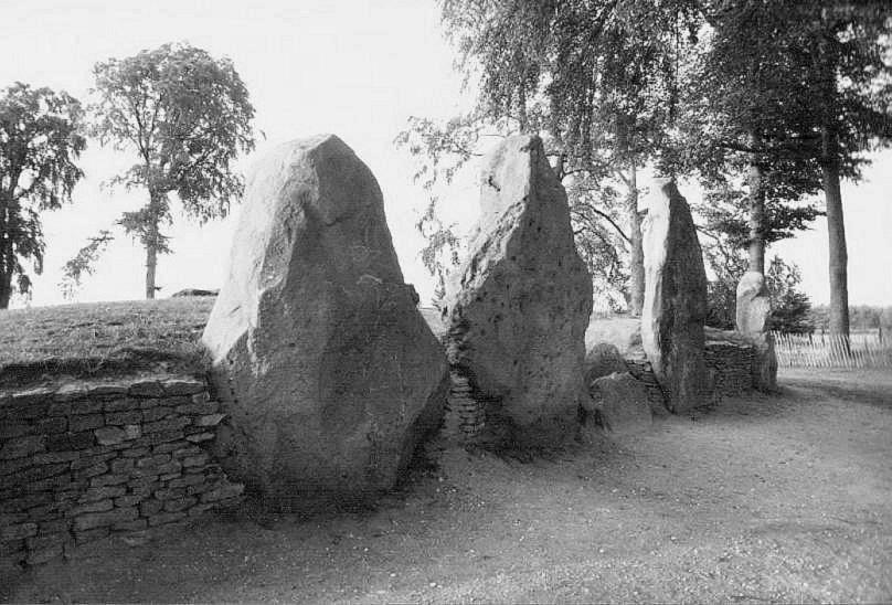
Whispering Knights Burial Chamber County: Oxfordshire O.S. Grid Ref: SP 299 308 O.S. Map (Streetmap) Photo Size: 82 KB / Date: May 1989
A written reference from the eighteenth-century states that the stones were then surrounded by a round barrow, but there is no trace of this today. Some 1180 ft (360 m) to the WNW of the Knights - and dating from a much later period - is the famous Rollright Stones stone circle, also known as the King's Men (SP 296 308; see satellite photo). It is 103� ft (31.6 m) in diameter and comprises 77 knarled stones arranged in a near-perfect circle. The King Stone (107 KB, SP 296 309) is a crooked monolith positioned some 240 ft (73 m) to the North-east of the stone circle; it is in fact sited in the neighbouring county of Warwickshire. The stone is 8 ft (2.5 m) tall and 5 ft (1.5 m) wide and, like the Knights, is surrounded by railings. The monolith is thought to have served as a marker-stone for a cairn cemetery which dates from the Early Bronze Age. |
|
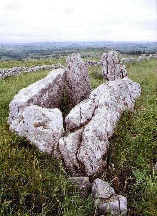
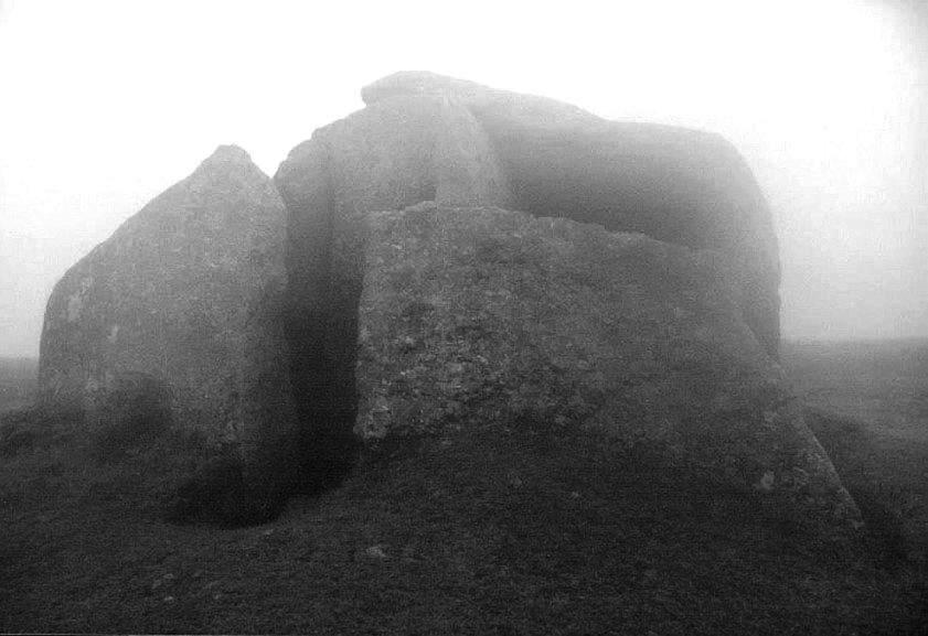
Chambered Cairn County: Cornwall O.S. Grid Ref: SW 469 380 O.S. Map (Streetmap) Photo Size: 57 KB / Date: June 1991
Two giant portal slabs restrict the entrance to an antechamber whilst access to the main chamber is only possible through a narrow gap at the South-western corner. The rear supporting upright has fallen inwards causing the capstone to slide backwards and sideways. Excavation revealed cremated bones, flint and Neolithic-style pottery. According to a local legend, should the stones of this chamber ever be removed, they will return of their own accord! |
Hurston Ridge a.k.a. Water Hill, Watern Hill Stone Row County: Devon O.S. Grid Ref: SX 673 825 O.S. Map (Streetmap) Photo Size: 126 KB / Date: August 1987
The function of these rows is not known, although the majority are associated with burials (due to their proximity to cairns or stone circles) and they may have served as processional ways during ritual activity. Some of the stones in this particular row are paired as flat-topped and triangular stones, leading to the suggestion that they might have held a male-female symbolism. A prehistoric field boundary, known as a reave, cuts through the row - presumably the reave was constructed at a later date. |
Badbury Rings Hillfort County: Dorset O.S. Grid Ref: ST 964 030 O.S. Map (Streetmap) Satellite Photo (Google Maps) Photo Size: 91 KB / Date: June 1991
The fort has two entrances - at the East and West - the Eastern one having an inturned entrance, the Western having a rectangular enclosure projecting from the middle rampart. Just outside the Eastern entrance are three Bronze Age round barrows, which are known locally as the 'Three Kings'. Two later Roman roads pass close to the fort; indeed, a section of the Ackling Dyke impinges on its northwestern edge. The fort is one of several identified as Mount Badon or Badon Hill, where King Arthur is said to have defeated the Saxons around 518 AD. A local legend says that he lives on as a raven in the wood. |
 Neolithic
Tombs in South Wales
Neolithic
Tombs in South Wales
Copyright Martin J Powell 2001 - 2017


 Prehistoric
Sites in Wales
Prehistoric
Sites in Wales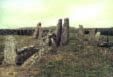 Prehistoric
Sites in Scotland
Prehistoric
Sites in Scotland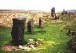 South
Dartmoor in 3D Stereo
South
Dartmoor in 3D Stereo