![]()
|
|
Prehistoric Sites in
WALES
by Martin J. Powell
Page 5 of 5
Click on a thumbnail to see a full-size picture. The Ordnance Survey Map links (O.S. Map) point to the 1:25,000 scale map of the region (equivalent to the O. S. Pathfinder Series of printed maps), as displayed at Streetmap.co.uk.
The abbreviation 'Ast' indicates that the site is included in the archaeoastronomy study of monuments in South Wales.
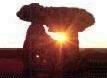
Barclodiad y Gawres Chambered Cairn/Passage-grave County: Anglesey (Ynys M�n) Ordnance Survey Grid Ref: SH 329 707 O.S. Map (Streetmap) Satellite Photo (Google Maps) Photo Size: 148 KB / Date: July 1987
The site was excavated from 1952-3. The covering mound was found to be originally turf, about 90 ft (27 m) in diameter, covered with a layer of stones. The passage, whose entrance faces about 30� West of North, is 20ft (6 m) long and leads to a cruciform layout of chambers, with three side chambers branching off a central burial chamber. That on the Eastern side is a single chamber while that on the West is double; the cremated remains of two young men were found here, mixed with the fragments of antler, or bone, pins. In the central chamber was a hearth, about 3 ft (1 m) in diameter, which showed evidence of a long-lasting fire. Over this had been poured a 'magical potion' which included the remains of reptiles, fish, shellfish and small mammals. At least five of the orthostats walling the passage and chambers are decorated with fine examples of megalithic art; namely chevrons, spirals, circles and lozenges. The excavators speculated that the carvings may have been coloured during the tomb's use, perhaps using pebbles of carbonised shale; indeed, in the total darkness of the original chamber and passage, coloration may have been necessary to ensure that the decorations could be seen by candlelight. Some time after the excavation, a concrete dome was built over the site, topped with glass, primarily to protect the site but also to enhance the visitor experience of being 'inside' the mound (note that public access to the tomb is restricted; see Cadw's website for details). The monument is thought to date from the later Neolithic period, ca. 2500 BC. In terms of its design and its stone decorations, it has many similarities to the Boyne Valley sites across the sea in Ireland. Bryn Celli Ddu (see Page 1), 11 miles (18 km) away to the East, can also be considered a 'close cousin' of this site. A reconstruction painting by Paul Jenkins (ca. 1980) of a funerary ritual taking place inside the tomb, in which a libation is being poured over the ashes, can be seen at the National Museum Wales website (note the decorated stones in the background). The name Barclodiad-y-gawres ('the Giantess's Apronful') refers to a local legend in which a mythical giantess was said to have created the tomb after dropping piles of stones on to the land. |
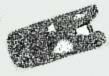
Crugyrafan a.k.a. Crug yr Afan Round Cairn/Round Barrow County: Bridgend (West Glamorgan) O.S. Grid Ref: SS 920 954 O.S. Map (Streetmap) Satellite Photo (Google Maps) Photo Size: 136 KB / Date: January 1987
Crugyrafan ('mound of the raspberries') is one of the largest sites of its type in the region. It was clearly a site of significance to the ancient peoples, judging by its size and the prime location chosen for the cairn, with magnificent views in nearly all directions. The monument appears to have been constructed in two phases; it was initially a round barrow, then a round cairn was later built on top of it. The initial central barrow, 65 ft (20 m) across and 3 ft (0.9 m) high, was surrounded by a berm, which itself was surrounded by a ditch some 90 ft (28 m) in diameter. In its former condition, archaeologists consider the site to have been a mountain-zone variant of a type of barrow known as a bell-barrow, which are typically found in the ancient 'Wessex' region of Southern England. A cairn of medium-sized boulders was then placed on top of the barrow; it was about 32 ft (10 m) across and 3 ft (0.9 m) high. The cairn may have been surrounded by a ring of upright stones (thus forming a cairn-circle), though any such stone ring is no longer visible; one upright stone can be seen on the cairn's Eastern perimeter. The small cairn (126 KB) which is now visible on top of the barrow is a relatively modern construction. The site was excavated in 1902. Cremated bones were found contained inside a cist (a box-like chamber) together with a grooved ogival dagger dating from the Early Bronze Age period (ca. 2500 to 1450 BC). In the 1960s pollen samples were obtained from the cairn which indicated that heather moorland and oak woodland were widespread in the region during the Neolithic and Early Bronze Age periods. Visible on the skyline some 2� miles (4.1 km) to the South-east is the Garn Fawr cairn on Mynydd William Meyrick (SS 952 927). It has been suggested that this cairn indicates the position of the midwinter sunrise when seen from Crugyrafan. |
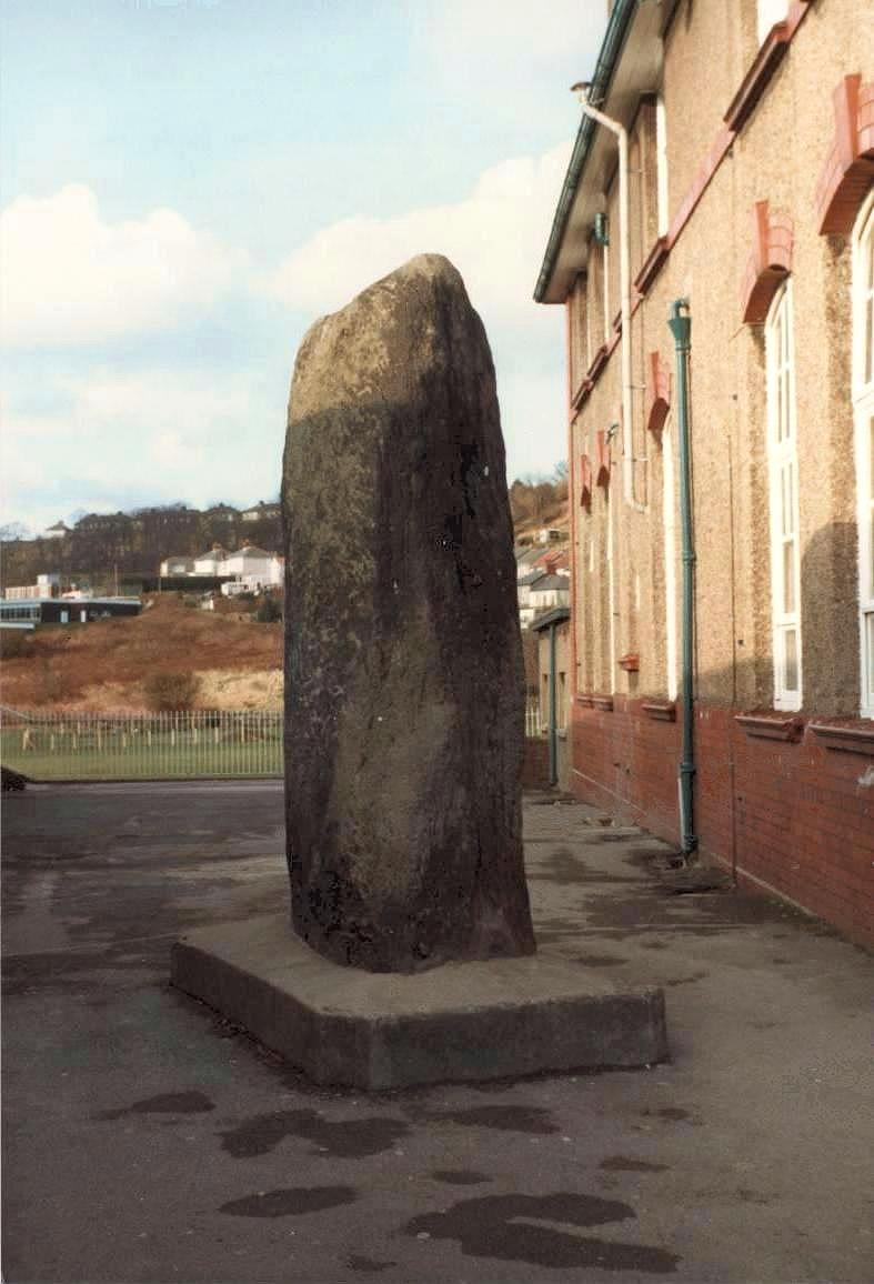
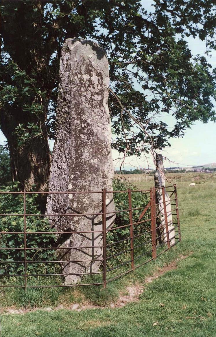
Carreg Hir a.k.a. Gareg Hir, Penrhiwtyn Stone Standing Stone County: Neath Port Talbot (West Glamorgan) O.S. Grid Ref: SS 744 953 O.S. Map (Streetmap) Photo Size: 92 KB / Date: March 1987
The Carreg Hir ('long stone') is 9 ft 2 in (2.8 m) high, 5 ft 7 in (1.7 m) wide and about 2 ft (0.6 m) thick. The stone was re-erected into a concrete plinth in modern times (presumably for safety reasons during construction of the school in the early 20th century) though it is believed to be in its original location. Archaeologists think that the monolith may once have stood upon a mound, overlooking the River Neath. There is a published 1848 reference to this stone in which it says that "there is a charm, not yet discovered, which can compel [the stone] to speak, and for once to reveal the secret of its history: but that having once spoken it will be silent forever." Another legend says that there is an underground passage leading between the stone and Neath Abbey some 1.3 miles (2.1 km) to the North; the stone is said to be aligned upon it. Whatever the stone's date and original function, the author is reliably informed that it was used as a meeting place by the school staff on their work breaks! |
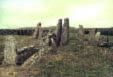
Presaddfed Chambered Tomb County: Anglesey (Ynys M�n) O.S. Grid Ref: SH 347 809 O.S. Map (Streetmap) Photo Size: 173 KB / Date: July 1987
The Southern chamber is the better preserved, having four upright stones supporting a capstone measuring 13 ft 9 in (4.2 m) by 10 ft 10 in (3.3 m) and 2 ft 3 in (0.7 m) thick. The chamber stands to a height of 3� ft (1.1 m). A recent geological assessment of the site determined that three of the stones (including the capstone) are conglomerate and are glacial erratics, having been obtained from the immediate vicinity of the monument. The Northern chamber is positioned 6� ft (2 m) to the North. Only two stones are now upright, one of them standing 6 ft (1.8 m) high, the other leaning against it. The chamber's capstone partly rests against both uprights. The site was excavated in 2013 with the primary aim of determining the source of the stones used to build the monument. The excavation revealed two charcoal-filled scoop hearths near the collapsed chamber, along with a couple of post-holes. Finds from the site were sparse, comprising several pieces of flint and a few possible hammerstones. A socket for a standing stone was found inside the collapsed Northern chamber, which was possibly in place before the dolmen itself was built. This would appear to parallel the construction of similar sites in South-west England (e.g. Trethevy Quoit in Cornwall; see Page 5 of the Prehistoric Sites in England gallery) where a single standing stone formed the primary focus of the subsequent monument. The original form of Presaddfed can only be guessed at, based on the design of other tombs on the island. The two chambers appear to have no structural connection between them, though they were probably once contained within a common cairn, of which only traces were found during the excavation. There is a tale told that, at sometime in the nineteenth century, the Southern chamber became a squat for a farmer who had been evicted from a house in the area. Interestingly, the recent excavation revealed 18th-century ceramics close by, lending some support to the story. |
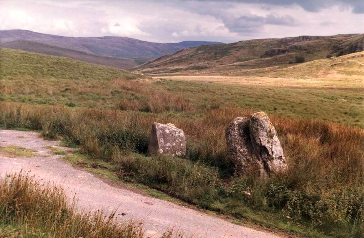
Buwch a'r Llo a.k.a. The Cow and Calf Standing Stones (Stone pair) County: Ceredigion (Dyfed) O.S. Grid Ref: SN 723 833 O.S. Map (Streetmap) Photo Size: 131 KB / Date: August 1986
The larger, Western stone is 6� ft (2 m) high and about 4 ft (1.2 m) broad at its base. The smaller stone is 4 ft (1.25 m) high and 4 ft (1.25 m) broad at its base; a benchmark has been carved into its Northern face. The stones are about 13 ft (4 m) apart. There is a third stone some 120 yards (110 m) to the West of the pair, beside the forest track; it is now broken, having apparently been struck by machinery at some time during the last century. It has recently been suggested that these stones may have been waymarkers for a Bronze Age trackway which once led from the West coast (near Aberystwyth) into the lower slopes of the Plynlimon mountain range (to the North-east of the site). There are numerous standing stones in the region, which appear to define the route of the proposed trackway. A half-mile (0.9 km) to the North-east of the Cow and Calf, on the Western-facing slope of Disgwylfa F�ch hill, is an unimpressive standing stone (110 KB, SN 731 837) measuring 3� ft (1.1 m) high by 3� ft (1 m) wide. It is stumpy in appearance and may even be a natural in situ boulder. |
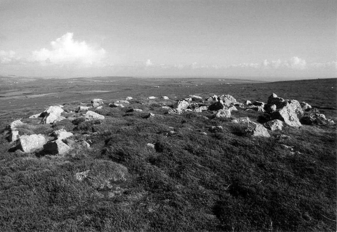
Rhosili Down Cairn II a.k.a. Rhossili Down Cairn II Round Cairn/Cairn-Circle County: Swansea (West Glamorgan) O.S. Grid Ref: SS 420 890 O.S. Map (Streetmap) Satellite Photo (Google Maps) Photo Size: 133 KB / Date: April 1988
Occupying much of the narrow ridge of the Down are around twenty or so round cairns dating from the Bronze Age period. This particular example is one of the better preserved of the group; it is about 30 ft (9.1 m) in diameter and the stones stand to a height of about 1 ft 9 in (0.55 m). Archaeologists refer to it as a platform-cairn because it was constructed on a man-made stone platform which stood about 1 ft (0.3 m) above the natural surface of the moorland. The cairn has a circle of conglomerate kerb-stones around its perimeter, though these mostly only survive on the cairn's Southern side. There is a small hollow just to the South of the cairn's centre which may have been the former location of a cist burial, which was robbed and destroyed at some unrecorded time in antiquity. About 9 ft (2.8 m) from the cairn's South-eastern edge is a small upright block, which may have been deliberately placed - a so-called outlier. It may have been a marker to indicate the cairn's position to passers-by lower down the ridge, or perhaps it indicated an astronomical event seen from the cairn's centre, such as the most Southerly moonrise over the distant horizon [Ast] |
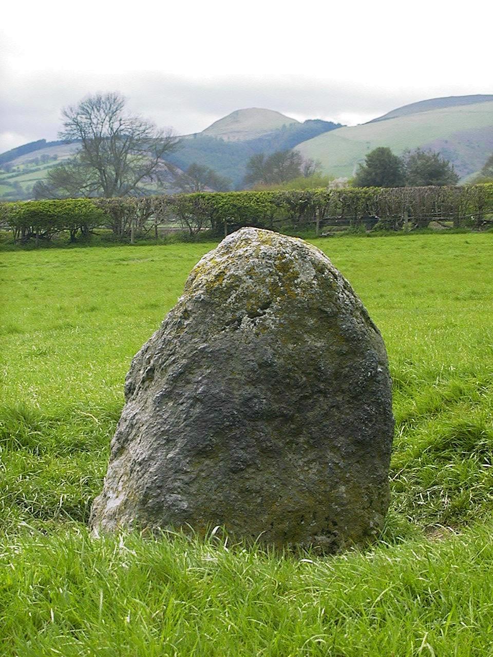
Meini Hirion a.k.a. Llanbedr Stones Standing Stones County: Gwynedd (Merioneth) O.S. Grid Ref: SH 583 270 O.S. Map (Streetmap) Photo Size: 249 KB / Date: July 1987
The stones stand beside an oak tree and are 10� ft (3.2 m) and 6 ft 5 in (1.9 m) tall, on a North-South alignment. The iron railings visible in the photograph (taken in 1987) have since been removed. A few early accounts refer to the presence of a third stone about 3 ft (1 m) tall, though if it ever existed, it has long since disappeared. It has been suggested that they may be the remnants of a stone circle, though there is no archaeological evidence to support this. Some 185 yards (170 m) to the East of the stones, in St Peter's Church (SH 585 269) is a stone slab some 2 ft 10 in (0.9 m) tall with a fine spiral carved into it. The spiral measures about 11 in (28 cm) across and has seven convolutions. The stone was found in the mid-19th century, apparently amongst the ruins of a prehistoric hut circle in the hills above Dyffryn Ardudwy village. However, since the spiral is carved in a Neolithic style reminiscent of those found in the chambered tombs of Anglesey and the Boyne Valley in Ireland, it is more likely to have derived from a burial chamber in the region. Photographs of the stone can be seen at the British Rock Art Collection website. After its discovery the stone seems to have been placed between the two Meini Hirion, where it remained until the early 20th century when it was moved to the churchyard, propped-up against the church's Western wall. The stone was eventually moved to its present location in the rear nave section of the church. In 2013 a close re-examination of the carved stone revealed the presence of two previously unseen cupules incorporated into the spiral design. Beneath the spiral, three elliptical designs were discovered, pecked to a shallow depth and 'near-impossible to view' except in very oblique lighting conditions. At least one of the three included a triangular motif attached to the ellipse, giving the appearance of a fish. Since the fish is traditionally considered to be a symbol of the Christian era, it is thought that these carvings were probably added to the stone in the latter half of the 19th century, when the stone was located in the churchyard. Quite appropriately, the fish is also associated with St Peter - after whom the church is dedicated. |
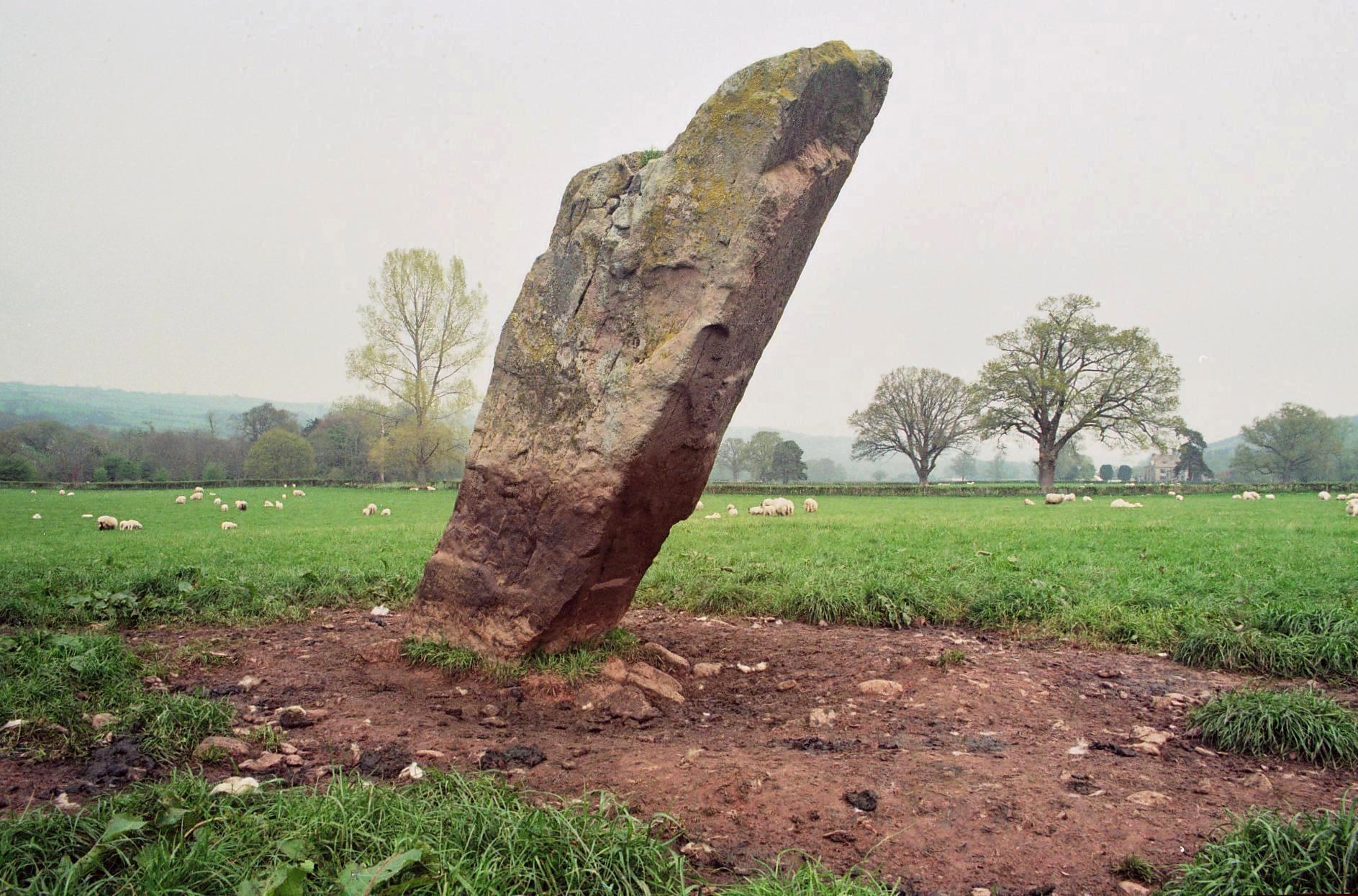
Llangoed Castle a.k.a. Llyswen Stone, Maen Hir Standing Stone County: Powys (Brecknockshire) O.S. Grid Ref: SO 123 396 O.S. Map (Streetmap) Photo Size: 374 KB / Date: May 2004
The maen hir is 7 ft 8 in (2.3 m) tall, 2 ft 7 in (0.8 m) wide and 1 ft 9 in (0.6 m) thick. It leans towards the South-west at a remarkable angle of 35� from the vertical. There are at least thirty small hollows (5 KB, cup-marks?) on the lower half of the stone's South-western face, though it is difficult to determine whether these are man-made or natural. Archaeologists have reported the presence of a 'D-shaped' ditched feature in the immediate vicinity of the stone, which may or may not be contemporary with it. Writing in the 1690s, the antiquarian Edward Lhuyd referred to 'Y m�n p�g a high stone near Llan G�d' - a probable reference to this stone - making it one of the first prehistoric sites in Brecknockshire to be recorded in literature. |
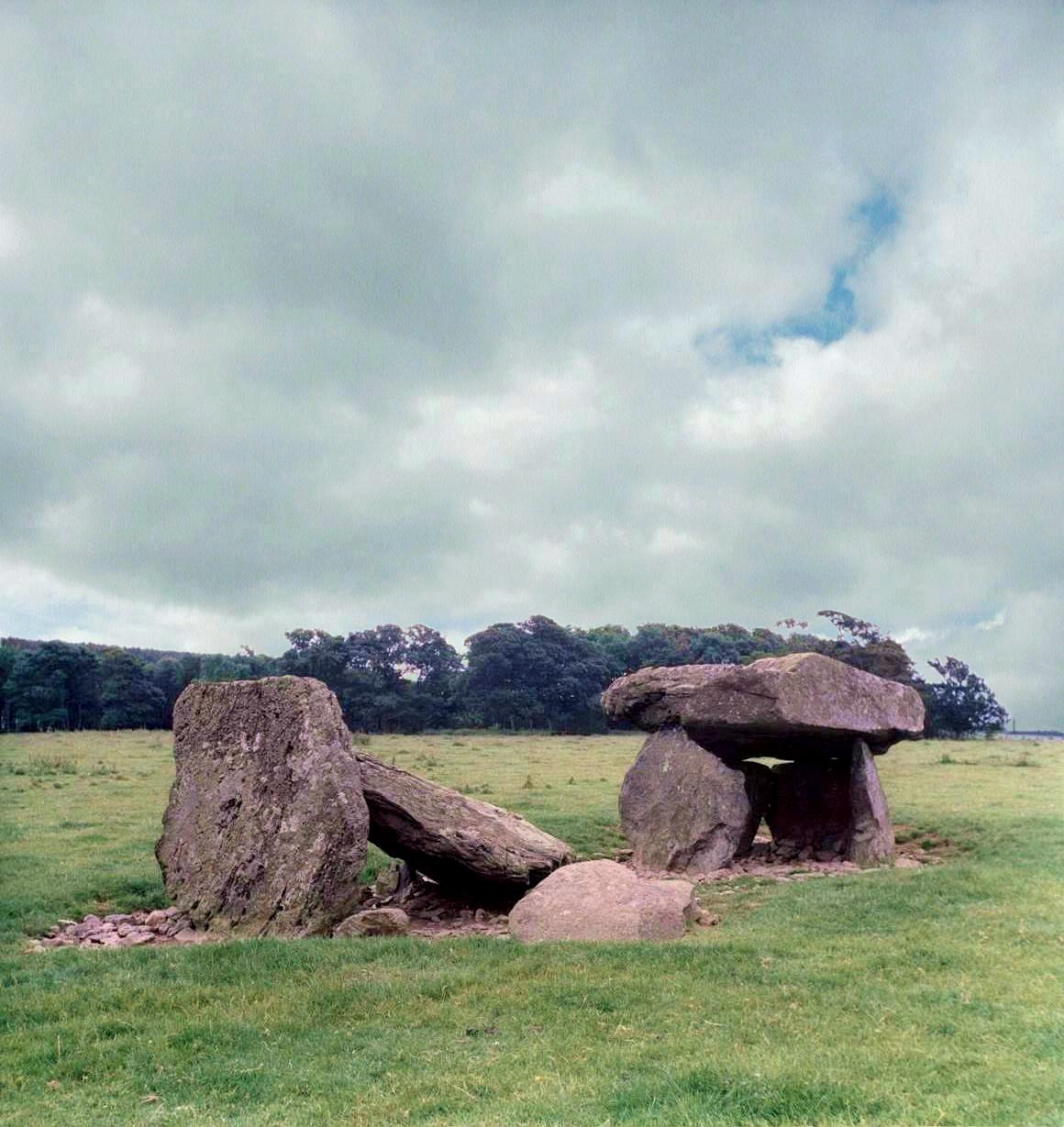
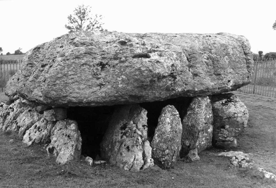
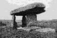
Lligwy Cromlech a.k.a. Arthur's Quoit or Coetan Arthur Burial Chamber County: Anglesey (Ynys M�n) O.S. Grid Ref: SH 501 860 O.S. Map (Streetmap) Photo Size: 151 KB / Date: July 1987
The limestone capstone is nearly square in plan, measuring 19 ft (5.9 m) by 17 ft (5.2 m) by 3� ft (1.1 m) thick. It is estimated to weight 25 tonnes. The monument originally stood to a height of about 6� ft (2 m); it appears somewhat 'stunted' today because centuries of soil has built up around the site. The tomb was built over a natural fissure in the rock, which served as the burial space; it was probably entered from the Eastern end. Only three of the eight side stones actually support the capstone. The site was excavated in 1909, when bone fragments of between 15 and 30 individuals were found. There were also animal bones, pottery fragments (pot sherds) and flints. The upper layer of deposits had been covered in mussel and limpet shells - possibly the remains of a funeral feast. Evidence from the excavation findings suggested that the tomb, whilst constructed in the Neolithic, may still have been in use in the Bronze Age. There is a legend associated with this cromlech in which a fisherman is said to have fallen asleep inside the chamber and dreamt that he had rescued a beautiful maiden from the stormy seas. However, she was in fact a witch and she gave him a golden ball containing a snake-skin charm which he had to wash in the sea once a year. The Romano-British settlement of Din Lligwy (SH 497 861), which contains the walled remains of two circular and seven rectangular huts, is located about 0.3 miles (0.4 km) to the West of the cromlech. |
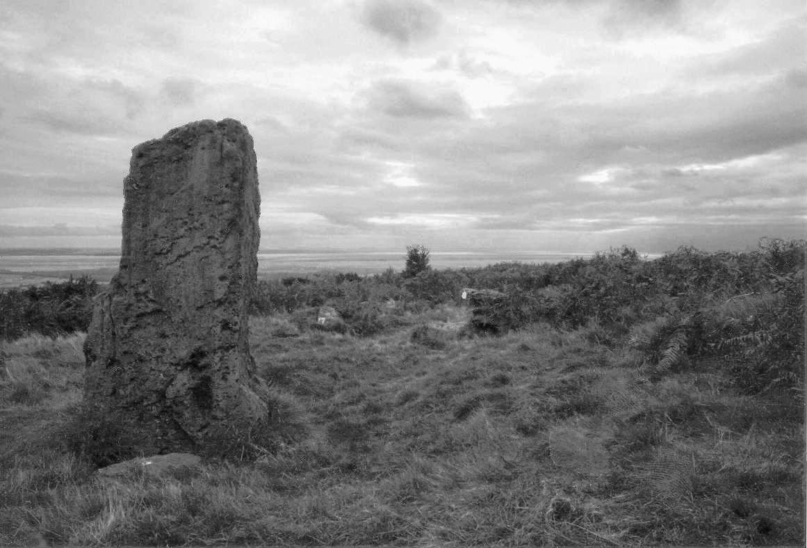
Kinnerton Court Stone I Standing Stone County: Powys (Radnorshire) O.S. Grid Ref: SO 246 627 O.S. Map (Streetmap) Photo Size: 254 KB / Date: April 2004
The stone is 4 ft (1.2 m) tall, 3 ft 3 in (1 m) wide at its base and about 3 ft (0.9 m) deep, and stands in a shallow pit. Perhaps the most striking feature of this stone is its similarity in profile to that of the Whimble hill, 2� miles (4 km) to the West - a observation first noted by local photographer and ley-line proponent Alfred Watkins in the 1920s. He described it as a mark stone which, he explained, "made assurance to the way-farer that he was on the track". In this case, however, Watkins' ley-line (or simply ley, as it was then called) did not pass through the Whimble itself, but in a NNW-SSE direction. The stone has been dismissed by some as a cattle-rubbing post, erected in recent centuries, however its shape and similarity to other standing stones in the region - in particular those of the Four Stones (see Page 3) compels one to believe that the stone was most likely erected in prehistoric times. Indeed, it may have served as an indicator of the equinoctial sunsets taking place behind the Whimble. The Kinnerton Court II standing stone (SO 244 628) is about 140 yards (130 m) to the North-west of Stone I, on a sharp bend in the road; it is 3 ft (0.9 m) tall by 2 ft 4 in (0.7 m) wide. It may have been moved in more recent times; it has fallen and lies beside a drainage ditch. |
Gray Hill a.k.a. Grey Hill Stone Circle & Standing Stones County: Monmouthshire (Gwent) O.S. Grid Ref: ST 438 935 O.S. Map (Streetmap) Site Plan (19 KB) Photo Size: 107 KB / Date: October 1989
It is unfortunate that the only known stone circle in South-east Wales should today be such an unspectacular sight. It lacks the majesty of other, larger circles in Wales, and in fact it may be better classed as a cairn-circle rather than a true stone circle. The ruinous state of the site, confounded by the natural boulders spread across the moorland, has resulted in many differing interpretations by numerous independent researchers, in terms of both its original layout and the astronomical alignments that may once have existed. What the site lacks in grandeur, however, it makes up for in its environmental setting; there are commanding views towards the South over the Gwent Levels, while in the far distance across the Bristol Channel in England are the uplands of Exmoor and the Quantock Hills. The circle is 32 ft (9.8 m) in diameter and is slightly egg-shaped, its long axis orientated East-West. It comprises nine upright, low-standing boulders which are visible within a clearing in the moorland bracken. Other possible members of the circle bring the total stone count to thirteen; several more stones are known to have been removed since 1868. Two large stones lie inside the circle; one of these, measuring 8� ft long by 1� ft wide (2.5 m by 0.4 m) was shown upright in a sketch drawn by a local artist in 1893. The two standing stones were once the most visible part of the monument when approached from the summit of the hill, but today they can only be seen from close range due to the tall vegetation. An outlier at the circle's North-eastern side is about 6 ft (1.8 m) tall, 3 ft (1 m) wide and 1� ft (0.5 m) thick; a small tree now stands beside it. The second menhir (120 KB) is further uphill about 180 ft (55 m) to the North-west; it is 7 ft 3 in (2.2 m) tall by 3 ft (1 m) wide by 1 ft 4 in (0.4 m) thick, leaning North-eastwards into a slight pit. Two recumbent stones are positioned to the North-west of the circle, on the same NW-SE alignment as the standing pair. A significant but contentious astronomical alignment has been claimed between these two stones on the midwinter sunrise downhill to the South-east; this was first proposed in the 1930s by local writer and artist Fred J Hando, who included a sketch of the event in his celebrated publication on Gwent county. Other possible features have been put forward at the site, including a double stone row to the NNW of the circle (which could have been part of a processional routeway) and a stone marking the equinoctial sunset. A plan of the site published in 1889 includes stones on the circle's Eastern side which are no longer present. Only excavation could help determine whether these were genuine parts of the original layout or simply fortuitously-positioned natural boulders. A survey carried out from 1999-2000 identified co-axial field boundaries and hitherto-unknown cairns across the hillside. A large 'D-shaped' enclosure, of likely prehistoric date, was found on the upper slope of the hill, enclosing the stone circle and row (see the Prehistoric Society's newsletter account). The latter feature was excavated in 2002, together with a large ring cairn further down the hill, which measured 42 ft (13 m) across. The cairn most likely once contained a Beaker burial dating from the Bronze Age - the first of its kind to be identified in South-east Wales [Ast] |
 Archaeoastronomy
in South Wales
Archaeoastronomy
in South Wales
 Neolithic
Tombs in South Wales
Neolithic
Tombs in South Wales
Copyright Martin J Powell 2001 - 2017

 A
Round Barrow in Gwent
A
Round Barrow in Gwent